Grand Union Canal Cycle: Little Venice - Watford Junction
25th September 2005
![]()
|
|
|
|
|
|
|
|
|
|
|
Grand Union Canal Cycle: Little Venice - Watford Junction 25th September 2005
|
|
|
|
Perseverance paid off on this occasion, as this planned event almost didn't see the light of day, so to speak, almost turned into, well, a non-event! The arrangement was that I indicated to Andy Maynard that I would meet him at Kings Cross at 09h00 on the Sunday morning. I surfaced at about 5h30 and to be honest, I took a look at the Sunday morning schedule for the June - December 2005 train timetable for the very first time in a while, having up up to now assumed that there would be no problem. I soon realised that my options were limited. Due to planned maintenance on the lines via Welwyn Garden City, practically all of the trains specified the use of a bus service, while the rest of the trains routed via Hertford North, referred to buses at Gordon Hill. There was one possibility and that meant having to drive down there to catch the 7h28. The highway was clear. Upon arrival, I had little time to spare and reached the platform at precisely 7h28 (7h27 on the station monitors) but there was no train to speak of. Not a sausage! No announcements, no officials, no people! I went back downstairs. Save for a lady working in the station bookshop, whom I did not wish to vent my frustration out on, a young lass was struggling with the automated ticket machine and muttering to herself. She turned out to be an attractive fellow South African who had been travelling Europe for 6 months, had about 3 weeks to go and couldn't wait to get home to the approaching summer and family. Not many South Africans girls would rough it for 6 months, so I admired her tenacity. She in tended studying at Stellenbosch next year and her accent told me she was Afrikaans. Though distracted (girls have this clever, innocent way of stretching as if to release that early morning laziness, only to reveal a slim, delicate midriff - very sexy) I had taken account of the fact that the next departure was at 8h28. That would get in around 10h00, scuppering my plans in the process. I resorted to Plan B by returning to the car, remounting the bicycle on the rack and heading off to Cockfosters, the final northerly destination on the Piccadilly Tube Line and phoned Andy's voicemail in the process. He called back two minutes later and advised me to avoid this as bicycles were not allowed on this line. I had remembered that bicycles were not permitted on certain tube lines but had forgotten which ones. This skies were cloudy and grey and it began to rain. Well, there wasn't a Plan C, to be honest but I chose to head off down the A1(M) to Wembley and attempt to take a tube from Neasden on the Jubilee line. Upon arrival at the Tesco car park, it was raining heavily. I fathomed that impending disaster was in the air. Another call to Andy and he advised changing to the Metropolitan line at XXX. Crossing the footbridge, made for the tube station just up the 406 bypass. As soon as I saw two uniformed officials at the tube station entrance, my heart sank. Sunday morning maintenance work, meaning both lines were out of service. Didn't you know? I was on the point of giving up and in fact called Andy to say as much, let's save it for another day. My only commuter choice was to trundle down to Stonebridge Park on a bus, well I couldn't because of the bicycle, and take a train from there to Euston station, which was close to where Andy and Nikke lived. I realised that I may as well cycle there, as it wasn't too far away. I still wished to arrive on time (it was around 08h30) so I made another call to Andy. I reached Stonebridge Park station, which is shared by the Bakerloo tube train and the Silverlink metro to Euston, just as a bus arrived. I waited about half an hour on the platform before a filthy yellow and purple coach train pulled in , cursing the British transport system but only too pleased to finally be heading to Central London, which did not seem to want my presence that day, it seemed. Another call to Andy to let him know. He had not moved an inch from his home at that stage! We met at Euston. I desperately needed the loo, even at a cost of 20 pence and a cup of coffee. To the latter Andy generously obliged as he felt I had earned it! We discussed the plan and though it would only be 09h45 before we set off, the day was not ruined, as we could still make amends but shortening the route somewhat at our own convenience. My Nicholson canal guide 1, excellent value at around 10 quid, had arrive two days earlier. The map showed the towpath clearly and this volume mapped out the Lea and Stortford Canals, the Regent Canal, The Grand Union Canal (yes all the way to Birmingham, in fact!) and the Oxford Canal route. I had made first class double-sided photo copies on our Xerox colour copiers for Andy and I. |
|
|
 |
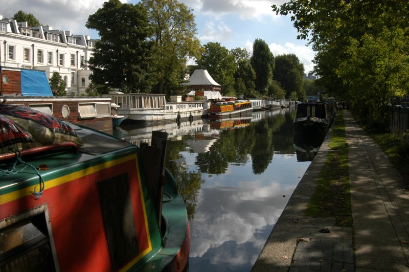
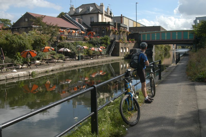
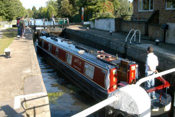
We decided that, as we were closer to Paddington than Kings Cross, we could cut out the Regents Canal section through Camden Town, London Zoo, Regents Park and Lords cricket ground, starting out instead from Little Venice, just beyond the junction of Paddington Basin and the Maida Vale tunnel, where the Regents and Grand Union canals in fact join. | 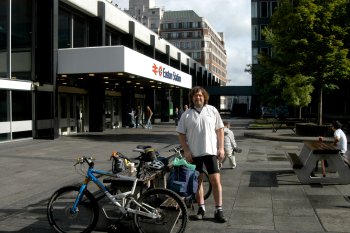 |
|
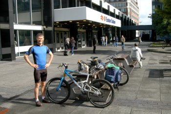
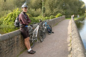
Andrew and I setting out from Euston Station. |
|
|
|
It was unlikely that we would get as far as Hemel Hempstead, but if we reached Watford Junction station in Watford Town centre, a Silverlink train could be taken, conveniently passing through Stonebridge Park. So today was going to be a good day after all. Besides, the skies were clearing and it warmed considerably. Perseverance had indeed paid off! We set off from Euston to Paddington, staying clear of busy, major roads through Marylebone, a lovely part of London. This was Andrew's territory, a trendy, upmarket part of London, neat and well kept, with numerous restaurants. We reached Little Venice around 10h15. One of England's first canals was built by the 3rd Duke of Bridgewater in 1761 to link the coal mine on his Woresley estate with Manchester's textile factories. This heralded the start of the canal building boom and by 1805, a 3000 mile (4800 km) network of waterways had been dug across the country, linking into the natural river system. Canals provided the cheapest, fastest way of transporting goods, until competition began to arrive from the railways in the 1840's. Cargo transport ended in 1963 but today nearly 2000 miles of canals are still navigable, for travellers who wish to take a leisurely cruise on a narrowboat (they are not referred to as barges). The Brentford to Uxbridge leg of the canal opened in 1794. The waterway, engineered by William Jessop and James Barnes, eventually linked London via Brentford and the Thames, with the canals of the Midlands. In 1929 the Grand Junction Canal was renamed the Grand Union Canal. The quaint old Grand junction Arms pub with moorings and children's playground at Acton Lane Canal Bridge bears testimony to the old name. The canal then widens. That many industries made use of the canal, comes as no surprise. A typical user was the huge Heinz factory, on the north side of the Canal at Park Royal. The Factory was built in the mid 1920s, and until the 1960s the company used the waterway as a supply route to bring in beans and tomato puree by boat from the London Docks, and to send the canned products in the opposite direction. |
|
|
|
|
|
|
|
|
|
|
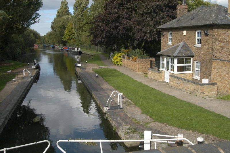
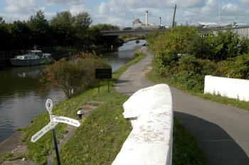
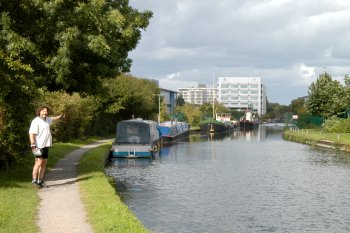
Towards Westbourne Green, at Little Venice, on the Grand Union Canal; Same spot, two directions, 15 minutes into the cycle, near Sainsbury's at Ladbroke Grove Bridge, opposite Kensal Green Cemetery. |
|
|
|
|
|
|
|
|
|
|
|
|
|
|
was amazed to see tiny 3-4 storey apartments adjacent to the canal, balconies cluttered with excess material. Bicycles hung on the outside. Though we weren't following the railway line I had travelled in on precisely just a short while before, we seemed pretty close to it, signage en route bearing names such as Willesden and Kensal Green, that seemed all too familiar. A check of the map showed that we weren't too far from Stonebridge Park railway station, as the canal aqueduct crosses the north circular A406 just south of where I had got on, between Park Royal and Alperton. Canals often have higher water quality than many urban streams. The Paddington Branch does not receive treated sewage, but some urban runoff is discharged into it. The canal is fed, via the main line of the Grand Union Canal, from the Frays River. This river water carries sewage effluent, which is high in phosphates. As a result, the Environment Agency classifies the water quality of the canal in Brent as "E: Poor" (the 5th out of 6 categories) (as at December 1999). On a much broader scale, the Grand Union Canal in this area runs west - east, as does the A4/M4 motorway and indeed, just south of it, the River Thames! For all intents and purposes, Andrew could have cycled from London and I could have met him at or near the aqueduct. In retrospect, I would have wanted to miss the first section, including cycling through London streets, for all the tea in China! The first aqueduct was built in 1933 and survived the attentions of wartime aircraft and of IRA bombers. It's quite surreal to find an aqueduct so high above the natural level of the land, with rush of traffic below. Further along the concrete towpath ends, changing into a rough, worn path on the grass verge adjacent to the canal. The Piccadilly Tube Line overhead bridge is in fact crossed just after the aqueduct. At one stage the new Wembley Stadium arch is just visible. By contrast, the rural landscape of Sudbury Golf Course and Horsenden Hill came into view, after bypassing Alperton cemetery. We reached Ealing Canoe Club, just adjacent to The Horsenden Hill Visitors Centre, near Ballot Box Bridge and watched from the opposite bank as a canoeist demonstrated the art of righting capsized canoe whilst still seated inside. Next to it is a children's adventure playground. |
|
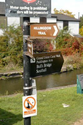
The sign says it all! |
|
|
|
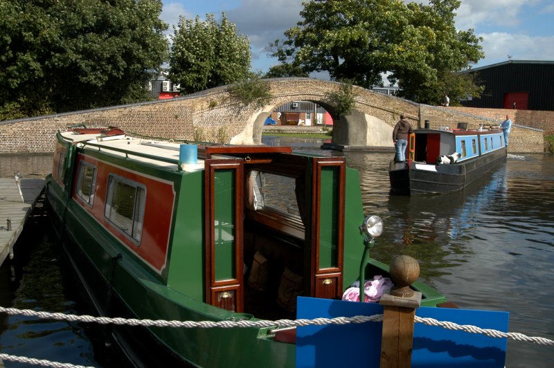
It is here that the canal acts as a wildlife corridor linking open spaces such as Perivale Wood, Horsenden Hill, Brentham open space and the Brent River Park. Much of the land next to the canal is managed by Ealing’s Parks and Countryside Service and contains a rich variety of plants and animals. The tranquillity of this setting seemed far removed from the bleak industrialised landscape that is west London, around Wembley Industrial Park, which I regard as one of the ugliest parts of the city, a conglomeration of metal and concrete warehouse structure. No doubt immensely successful businesses exist here. Nonetheless, this is the price paid for the sake of progress. Canals were the motorways of their time. Originally barges were horse drawn. One of their great advantages was that a horse-drawn barge could bear a 50 ton load, whilst a horse and cart could only carry 300 lbs. The canal brought industry to what was then a rural area. In the 1880’s hay was cut in the canal side meadows and taken into London. Continuing south through the industrial estate, the Paddingtom Arm reaches the junction main line of the Grand Union Canal at Bulls's Bridge near Southall. Halfway down this southerly section, one passes the magnificent Willowtree Marina, serving a variety of needs. Bull's Bridge, within spitting distance of the M4 motorway just north of Heathrow Airport, was once a British Waterways yard and formerly the Grand Union Canal Carrying Fleet Depot. |
|
|
 |
It has now been developed by Tesco supermarket chain. Turning left, the canal leads to east to Brentford. Turning right, the canal goes to Birmingham and beyond. The first section remains industrial in nature. We crossed under the A312 Parkway, then the railway line heading west, at Hayes and Harlington station, followed by the A437 and the A408 (Stockley Road). |
 |
|
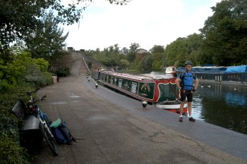
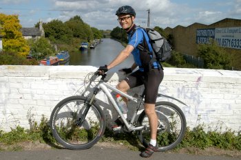
Bulls's Bridge Junction near Southall, just north of the M4 motorway, looking in the direction of the A312 Parkway; Andrew on his bicycle at Bull's Bridge, raring to go! |
|
|
|
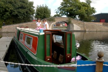
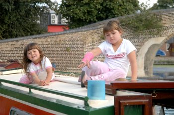
Metal barriers, similar to wooden stiles, located at regular intervals on the towpath and first encountered on the Paddington branch, now became a major source of irritation, causing us to dismount, slowing us down in the process. We stopped for lunch at the cosy Water's Edge Restaurant & Bar near Cowley Peachy, just as the canal begins to veer northwest. It is roughly here that the Slough arm of the Grand Union Canal heads west. In terms of a pub, the timing was just right, Andrew and I having just discussed how welcome a break would be. Andrew placed orders for beer and cider (my preference) and we both tucked into a hearty steak and ale pie, with mash and peas and yummy it was too. It was warm and it was a jolly spiffing day, wot! I snapped two kids frolicking on their Dad's narrowboat moored at the Water's Edge. Our hunger now satisfied, I could have done with a short nap; it was 13h00 and though good progress had been made, we needed to press on. |
|
|
 |
 |
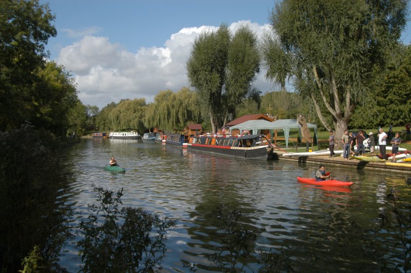
The landscape was consistently appealing to the eye. Scores of anglers lined the canal at regular intervals, their sport clearly immensely therapeutic and satisfying. If I said that we must have encountered more than 500 narrowboats en route during the duration of the ride, it's not a figment of my imagination. I wonder for what % of folk this is there main abode. |
|
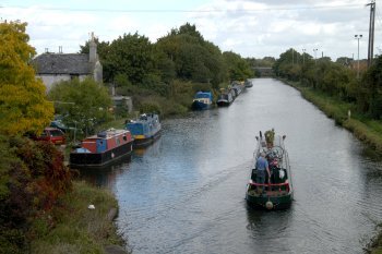
Looking up the Paddington leg towards London (the way we had come), at Bull's Bridge; A narrowboat moored at the Water's Edge Restaurant near Cowley Peachey. |
|
|
 |
Many narrowboats are enlivened with colourful paintings and attractive decorations, some of the older ones ordained with brass fittings. The folk manning them were testimony to a living canal. Many were out working the boats, grinding, sanding or painting them, dedicated to a unique way of life. One boat came by and I saw a mother platting her daughter's hair. | 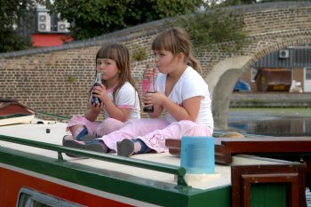 |
|
Kids having fun on Dad's narrowboat at the Water's Edge, formerly known as The Turning Point (for obvious reasons) and once the base of the Grand Union Cruisers' hire fleet. |
|
|
|
|
|
|
|
| Couples, families, the elderly and the young, walked the canal, some with dogs. I remarked to Andy that 80% of the dogs, for some strange reason, were Staffordshire Terriers. Once, just before a bridge tunnel, a mouse came scurrying down the embankment and charged over the edge. Images flashed through my mind as we raced along the towpath. | 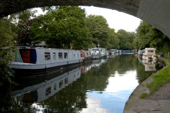 |
 |
|
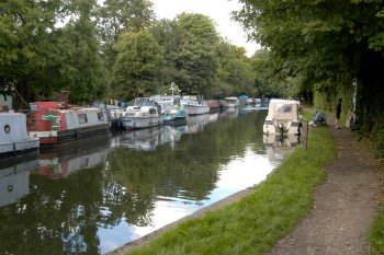
Benbow Bridge (before Cowley Lock) and moorings (mainly on the off side), many of them residential, from cruisers to working boat conversions. |
|
|
|
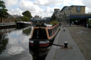
We were now running due north and parallel to the M25 Motorway. A series of locks now appeared. The reason? Cowley Lock, where one crosses over Iver Lane Bridge from the on to the off side (R-L), marks the end of the 27-mile pound and the start of the climb up the Colne valley and the Chiltern Hills. Uxbridge, just to the north, signals the limit of the outer-suburban belt that surrounds London. The Paddington Packet Boat used to run daily from Paddington to Cowley, being one of the few passenger boats plying regularly along the Grand Junction Canal. It was pulled by four horses and had precedence over all other boats, so it covered the 15-mile lock-free run in a time that was remarkable at the beginning of the 19th Century. Ever wonder how the term towpath originated? The Uxbridge Lock has an attractive setting with its lock cottage and turnover bridge. At some stage I got to wonder where our Xerox offices in Uxbridge might be located and whether those working there perhaps came down to the canal at lunchtimes for a moment of peace and relaxation. Well, believe me, just at that instant we rounded the next bend and there before us was this huge white building sporting the bright red X! The Xerox offices are located on Oxford Street amidst numerous other modern office structures, just down from Uxbridge Lock itself. Whether the design is incongruous with the general surroundings is debatable. |
|
|
 |
The Swan and Bottle next door provides a welcome location for corporate attempts to swing a deal, perhaps? I succumbed to the precocious efforts of a middle aged mother in her attempt to solicit me in taking her photograph, the result of the intoxicating mixture of great weather and a bit of the laughing water. I assured her that she would have her moment of glory in the following day's tabloids ....not. | 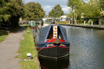 |
|
Xerox Uxbridge branch in the distance; View from Xerox in the direction of Uxbridge Lock, adjacent to The Swan and the Bottle pub, Oxford Road, Uxbridge. |
|
|
|
|
|
|
|
| From here on the landscape reached proportions of breathtaking beauty. The Colne Valley provides the first significant area of countryside west of London – a mosaic of farmland, woodland and water, with fifty miles of river and canal and over forty lakes. It is a living, working environment providing employment and homes for many people. It's also fairly free of industrial development. | 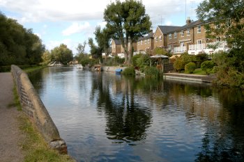 |
 |
|
Prime real estate and exclusivity adjacent to Troy Cut weir, near Copper Mill Lock; Andrew admiring the scenery. |
|
|
 |
It is also a special place, important for recreation and wildlife and of great interest to naturalists. Large areas are open to the public or accessible through a network of paths. At Denham Lock, a sign requested cyclists to dismount. With a rise of 11 ft 1 in, it is the deepest on the Grand Union Canal. The canal cuts past the villages of Harefield and Denham and its pristine lakes and woodlands. | 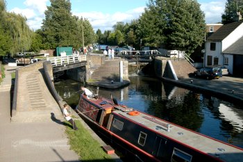 |
|
Navigating Batchworth Lock, near the town centre of Rickmansworth. |
|
|
|
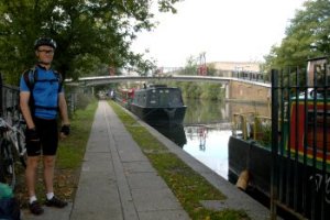
This is clearly sought after, prime, exclusive real estate and the price of a pad on the canal is, well, anybody's guess. The big mill at Copper Mill Lock was once a paper mill but after the canal was built it turned to making copper sheets for the bottoms of boats. South of here is the unnavigable but scenic Troy Cut, which leads to the very ancient Troy Mill. At Springwell Lock the canal turns slightly north-east. The interesting group of old farm buildings close by, when passing Stocker's Lock, date from the 16th Century. It is a fact that towards Rickmansworth one approaches exclusively millionaire's territory. Batchworth Lock is located on the outskirts of Rickmansworth. It is just north of Lot Mead Lock that the Metropolitan tube line crosses the canal just before it divides and feeds Rickmansworth on one leg and Croxley and Watford on the other leg. It was just short of Cassio Bridge Lock, just after the canal veers due north, that we left the towpath and headed into Watford Town Centre, on the Watford - Rickmansworth Road at Cassio Bridge. The cycle ride had been hard at times, especially where the towpath was rough and irregular. My bum hurt, to be sure. Where the path had been narrow in sections, no quarter had been given to cyclists approaching from the opposite direction. Shoppers in downtown Watford Centre were concluding their business as we made our way to Watford Junction station around 16h30. We purchased rail tickets. Andrew was on the fast train into London, while I once again boarded a Silverlink train, disembarking at Stonebridge Park, concluding the day's outing with a short cycle back to my car at Tesco, Wembley Park. Just as dusk set in, I headed back on the highway to Royston. |
|
|
|
|
|
Links to other websites: |
|
|
Recommended maps: |
|
|